The Historic England funded Chesil Beach Cannon Site interactive virtual tour is a showcase of two wreck sites and of the community project.
The Chesil Beach Cannon Site consists of two discrete clusters of ships’ guns located in a highly dynamic area close to Chesil Beach off the coast of Dorset, UK. They were discovered in 2010 by The Shipwreck Project and reported to Historic England who commissioned an undesignated site assessment; they were subsequently designated under the Protection of Wrecks Act (1973) in 2017 as two sites of unknown identity.
Take a tour with the icons or use the yellow icons to read more about the project . Tips on using this interactive can be found here: .
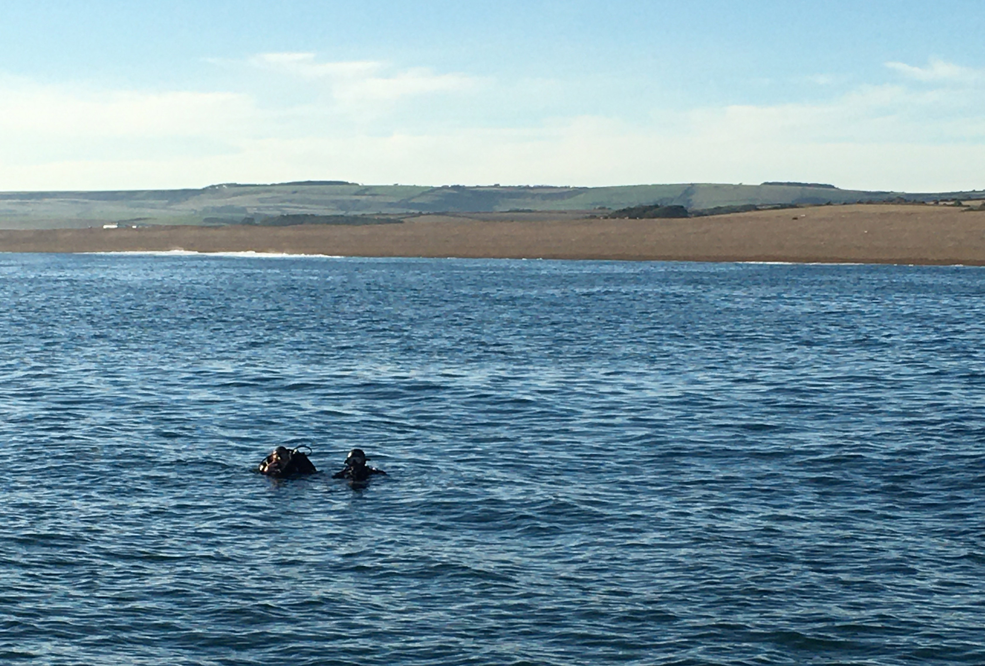
Both wreck sites are situated close inshore and are representative of the hundreds or even thousands of wrecking events that have taken place off Chesil Beach over the last few thousand years.
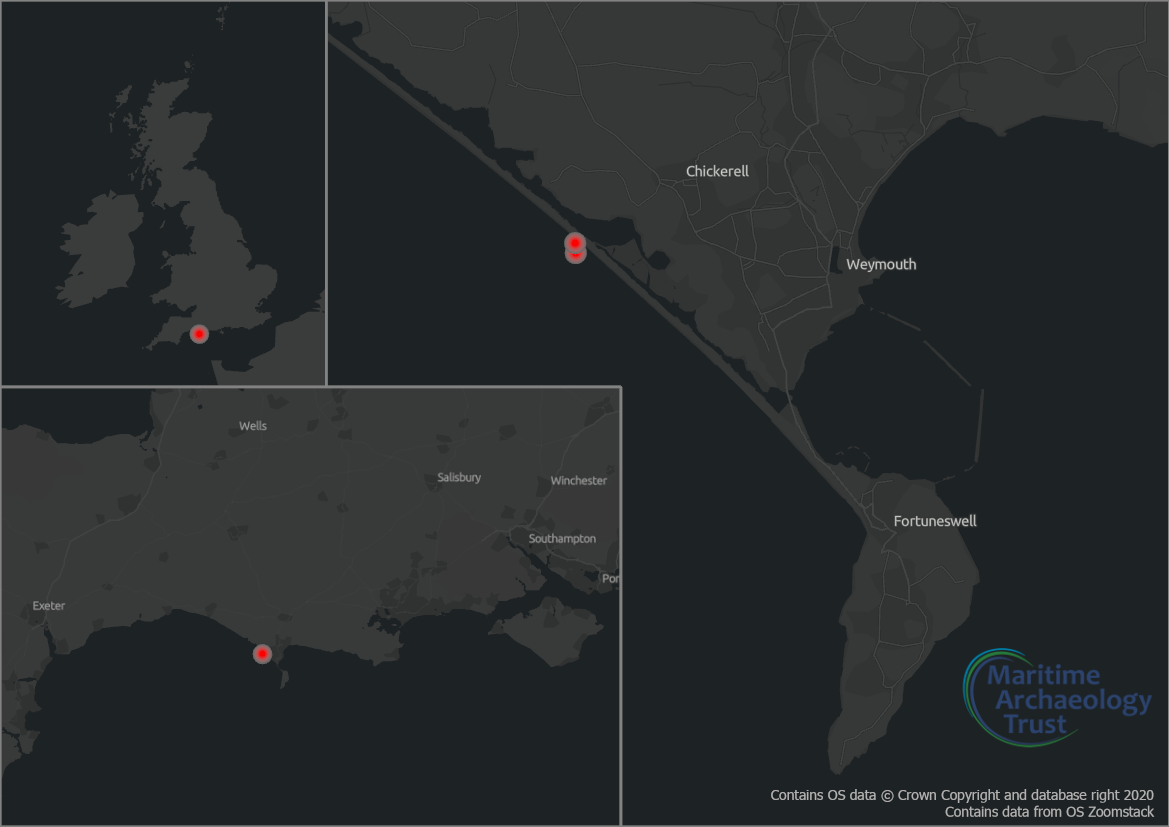
Chesil Beach itself stretches over 18 miles from Portland in the east to West Bay. It is an imposing barrier of shingle that has claimed many lives and vessels that found themselves driven onto this unforgiving lee shore.
The designation order under the Protection of Wrecks Act (1973) for the Chesil Beach Cannon Site is dated 18th August 2017. The designated areas are a radius of 30 metres around the locations shown on the map above.
The Chesil Beach Cannon Site is attributed in the National Heritage List for England (NHLE) under a single entry ‘Unknown Wreck: Chesil Beach (Cannon Site)’. The List Entry Number is 1433972.
Since discovery and designation, the sites have together been collectively known as the ‘Chesil Beach Cannon Site’. However, they have individually been referred to variously as the inshore site, inner site, or site 1, and the offshore site, the outer site, or site 2. The List Entry refers to the inshore and offshore sites which is also used throughout this interactive.
Though the identity of these wrecks remains unknown, it is likely that they were remembered by local people long after they were lost on Chesil Beach. Events such as these, while not uncommon, would often draw large crowds for the risky practice of salvage of cargoes and rescue of survivors.
Desk-based research has identified 25 possible candidates, with two vessels considered to be the most likely losses, based primarily on location, date and cargo.
De Hoop or Hope was a 1749 wreck of a Dutch West Indiaman which stranded at Chesil Cove en route from Jamaica and/or America to Amsterdam, laden with gold and silver coin, linen, woollen goods and tobacco. Constructed of wood, it was a sailing vessel and was armed. De Hoop is the best documented wreck which fits the circumstances and date although the large size of the guns seen here may cast some doubt on this. Whether it is likely that a Dutch West Indiaman would be carrying English guns is unclear, but guns can appear outside of their national context. For example, the protected warship London was carrying Dutch guns. De Hoop was wrecked and "became embayed in the Deadman's" which is Deadman's Bay, an inlet behind Chesil Bank.
A regional dive guide, Dive Dorset, makes reference to a site from where a cannon was recovered in somewhat spectacular fashion which is described as the Hope (or De Hoop):
“The place off Chesil Beach where 26 large iron cannon lie is the wreck of the HOPE. In the late 1970s a group led by Nowell ‘Chippy’ Pierce recovered one of the cannon from the site using a Royal Navy helicopter. Trial excavations also led to the recovery of a number of items including a huge plug of tobacco, still preserved beneath the pile of cannon and crud. A number of Dutch silver coins were also recovered from the site but kept secret at the time. The main bulk of the remains are found in 11m, lying 120 yards offshore, where the pebbles start to fade into the sandier seabed. The site lies a mile to the north-west along the beach from the Fleet crossing point at Chickerell. The cannon, cannonballs and crud forming a mound are easy to see.” (Hinchcliffe 1999: 96)
However, Squirrel was a British sailing cargo vessel which stranded on Chesil Beach soon after De Hoop in 1750. It was bound from Maryland for London, laden with 513 hogsheads of tobacco, which also matches the reference to the destructive salvage of material, including tobacco bales, in the 1970s.
The sites were rediscovered in 2010 by Grahame Knott and Richard Bright-Paul during work by the Shipwreck Project to locate and investigate the rich local underwater cultural heritage. Given the large number of losses on this shore and numbers of potential candidates, the possibility remains that these references are not all to the same sites, and that there may in fact be evidence of many of the twenty-five candidates identified so far scattered along Chesil Beach.
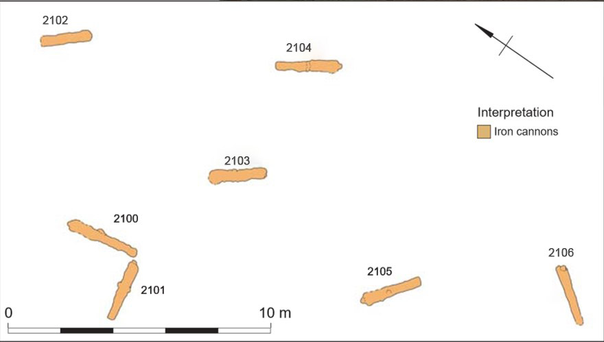
The inshore site comprises eight heavily concreted cast iron cannon identified as English 24-32 pounders cast between 1650 and 1725. Lying 220m south of the cannon assemblage, the offshore site consists of seven very heavily concreted cast iron English cannon, one of which is probably a six pounder, cast in the second half of the seventeenth century.
Further intrusive work will be required to understand the origins of these unusual enigmatic assemblages and their potential to reveal more about late 17th to early 18th century trade and society.
These two sites were discovered in 2010 by a side scan sonar (SSS) survey of the area by the community archaeology organisation, The Shipwreck Project. Two SSS anomalies were ground-truthed by divers who reported that the guns on both sites appeared to be similar. Subsequently, in 2014, during another SSS survey, The Shipwreck Project discovered a section of wooden ship’s structure near the two sites. It was considered possible that all three sites were the result of a single wrecking event.
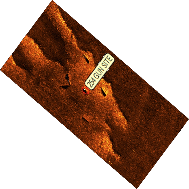
The Shipwreck Project reported these sites to Historic England who commissioned Wessex Archaeology to investigate the area in 2015. As a result of this investigation, the two clusters of guns were recommended for designation under the Protection of Wrecks Act 1973 and this was approved in 2017.
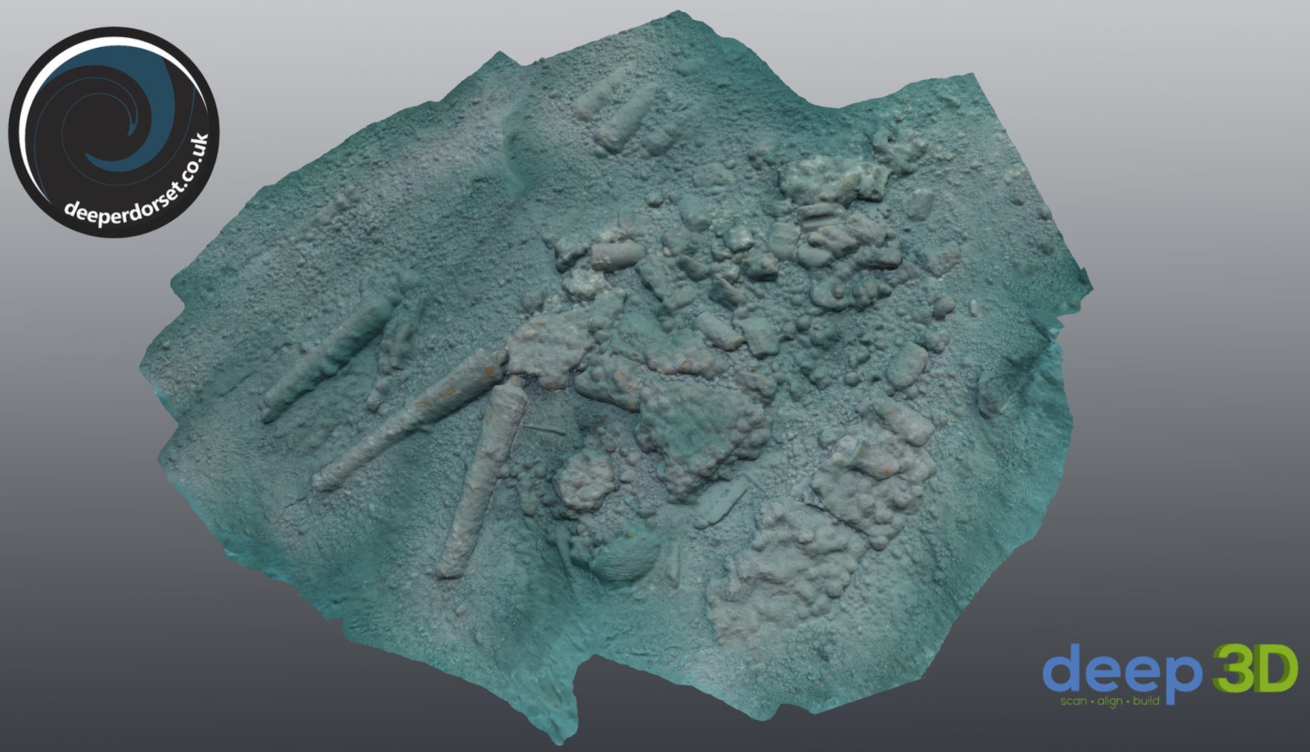
All three sites were investigated with a total of eight dives undertaken. The inshore and offshore sites were the main focus,but the third assemblage of timbers including planking and a frame was also recorded. It remains unclear as to whether or not this is associated with either of the wrecks. Wessex Archaeology were able to locate the sites using the Shipwreck Project's side scan sonar data, and then undertook a rapid photogrammetry survey of Sites 1 and 2, resulting in the first 3D view these sites.
In the same year, underwater photographer Simon Brown also undertook a photogrammetry survey of both sites. The inner site model shows just how much lower the sediment level was compared to the view in 2019.
The MAT and NAS undertook a programme of training, a field school and underwater survey from August 2019 to August 2020. Read more here: .
The two Chesil Beach Cannon Site areas are designated for protection under the Protection of Wrecks Act 1973. Protection under this act makes it a criminal offence to do any of the following without a licence: tamper with, damage, or remove any part of the wreck, carry out diving or salvage operations, or deposit anything on site which would damage it.
The sites are protected as they are two of the few known archaeological wrecks representative of the late 1700s or early 1800s. They also have the potential for more artefacts and structure to be preserved beneath the seabed, particularly under the guns. As the sites are in a dynamic, high energy environment, changes in seabed levels may expose more of this material in the future.
Archaeological survey and monitoring by divers will highlight any changes and ensure new material is recorded.
The Chesil sites are two of over 50 which are currently designated under this Act around the coast of England. Anyone wishing to dive one of these sites must obtain a licence to do so.
The following links to the HE guidance on accessing England’s protected wreck sites and also to the PWA webpages applying for a licence may be useful.
Although a broad date range for the sites has been established, it has not yet yet been possible to determine which ships they represent. The two sites may even represent a single shipwreck event.
To date no records have been discovered for warships carrying 24-32 pounder cannon lost in the area between 1650 and 1725. However, there are two possible candidates that could fit the site/s: the Dutch West Indiaman De Hoop, wrecked in 1749, and a British cargo vessel the Squirrel which wrecked in 1750.
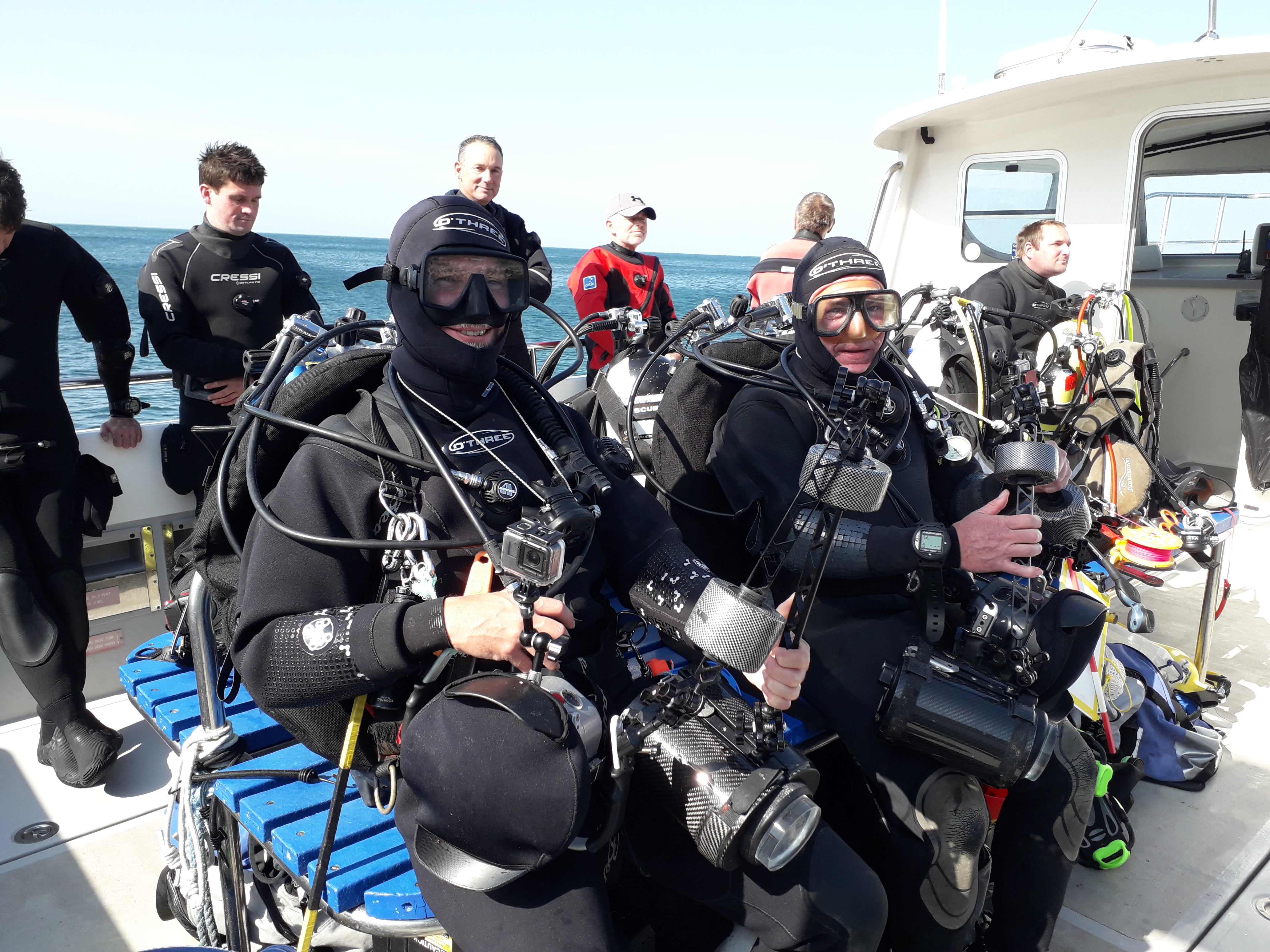
In 2019 and 2020 the Nautical Archaeology Society (NAS) and the Maritime Archaeology Trust (MAT) ran training activities and series of public events based around the Chesil Beach Cannon Site site off the coast of Weymouth. Activities were held in conjunction with the local licensees to create a team of local wreck custodians. By upskilling local community members, including divers, the wrecks will be respected and further investigated.
It is not that often that we are able to offer access to free training and project opportunities, but thanks to funding from Historic England, the Nautical Archaeology Society and the Maritime Archaeology Trust were able to do just that. We advertised for divers in Dorset and surrounding UK counties who were interested in becoming an active member of a protected wreck licensed dive team to register their interest for this training.
NAS and MAT put together a great project focussed on the Chesil Beach Cannon Site that included education, training, outreach events, this 3D dive tour as well as fieldwork on this protected wreck.
To participate as a diver we offered participants free introductory knowledge and skills through online and face to face training, as well as non-diving courses in gun recording and photogrammetry techniques. In order to qualify for FREE training all divers were expected to commit to at least 2 days volunteering on site between the 21-27 September 2019.
Read more about the project: nauticalarchaeologysociety.org/chesil
Though the sites appear to be relatively stable, there have been significant changes recorded between 2015 and 2020. While some of these are beneficial, such as increased sediment deposition at the inshore site, even these are indicative of the dynamic conditions and vulnerability to storm events as well as longer term sediment transport trends.
Human interference and damage has also been recorded during this period, including trawling or attempted theft of guns from the offshore site by divers. While it remains uncertain how the cannon were disturbed, it is clear that any continuation of such activity will cause loss of site material and will impact our longer term understanding of their significance and potential.
The dynamic nature of Chesil Beach, along with its range of protections for nature designations means there is likely to be a relatively wide range of data available on the long-term physical changes in the area. A detailed assessment of environmental data in relation to the sites is yet to be undertaken and would be beneficial to gain a more detailed understanding of the natural threats to the sites.
The Maritime Archaeology Trust and Nautical Archaeology Society are actively continuing discussion with Historic England to consider next steps for monitoring and investigation while continuing to support the Chesil Beach Cannon Site community team of divers and researchers as they work to protect these important sites and enhance our understanding.
This interactive tour has been developed by the Maritime Archaeology Trust.
The 3D models have been created by us based on images we collected during fieldwork in 2019 and 2020. While the conditions on the inshore site were clear and bright, the 2020 offshore site underwater environment was much darker and more turbid. Even then, the diving survey required several attempts between January and August of that year.
For this reason, we wanted to present a consistent environmental feel across both sites, darker and moodier than the 2019 survey, but brighter and clearer than the 2020 conditions. Thanks to the wonderful world of 3D realtime rendering, we can achieve this and change some of the environmental parameters on the fly.
You can adjust the lighting direction, and also change the render settings to view the model in an entirely different light! Click on the left menu controls to see how you can manipulate the scenes.
This interactive tour has been developed with the generous support of Sketchfab who are keen promoters of cultural heritage and provide a stunning platform with which to share and manipulate 3D data. Using the Sketchfab viewer API, we can build a rich interactive experience that has archaeological interest as well as aesthetic impact.
If you have any thoughts and feedback on the viewer, strengths, weaknesses or improvements, we'd love to hear from you:
Version: 1.0 March 2021
The inshore site comprises eight heavily concreted cast iron cannon identified as English 24-32 pounders cast between 1650 and 1725. Lying 220m south of the cannon assemblage, the offshore site consists of seven very heavily concreted cast iron English cannon, one of which is probably a six pounder, cast in the second half of the seventeenth century.
Both sites were discovered by Grahame Knott and Richard Bright-Paul of the Shipwreck Project in 2010 following a side scan sonar survey.
Although the historical record of shipwrecks from the 17th and 18th centuries demonstrates many losses, the location of in situ wreck remains from these periods is still relatively rare. Many sites identified from these periods are Naval wrecks, making the possibility that one or both of the Chesil cannon sites may represent cargo vessels particularly significant. It is likely that both sites preserve evidence of important aspects of English trade in a period when networks were being established and the process of colonisation was rapidly expanding.
Also, the Chesil Beach Cannon Site was discovered by local divers and the local community retains a keen interest in them and may be viewed as custodians. This has been an important aspect of this project which has sought to establish a local, skilled team with a passion for preserving this finite underwater cultural heritage resource.
There are two main candidates for these wrecks, De Hoop and Squirrel, but without further intrusive investigation it is very unlikely that any conclusive evidence will be found that will firmly identify these assemblages. In fact it is still unclear whether these even represent one or two different wreck sites.
The Chesil Beach Cannon Site is protected under UK law and access is strictly controlled. While anyone with experience in diving can apply to Historic England for a license to visit or survey the sites, the best way would be to join the community project and make a contribution to the ongoing efforts while also meeting new people with like-minded interests. Contact the NAS at for more information on how to get involved.
See also the following links to the HE guidance on accessing England’s protected wreck sites and also to the PWA webpages applying for a licence.
We would love to hear from you if you have any interesting knowledge of these sites or artefacts relating to them. You would be making a valuable contribution to this project:
If you have found something that you think might be inaccurate then please do let us know! Please email us on:
This interactive was created by the Maritime Archaeology Trust by our team of maritime archaeologists. 3D survey and models were also developed by our team, with realtime rendering by Sketchfab, supporters of the MAT.
The MAT is a charity and we rely on the kind support of volunteers and donors. We also have a Friends of the Trust organisation.
To volunteer: https://www.maritimearchaeologytrust.org/volunteering
For options on how to donate: https://www.maritimearchaeologytrust.org/donations
To join the Friends: Friends of the Trust